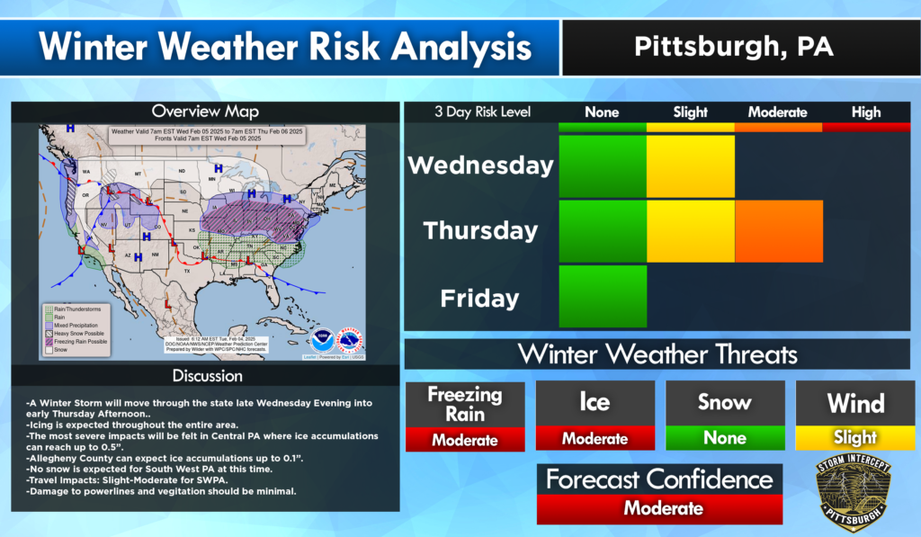
A Winter Storm will affect Pennsylvania Wednesday into Thursday. This storm will bring enough ice to make travel hazardous or even impossible. As of 12:30 pm on February 4th, over 0.25″ of ice is expected in Central Pennsylvania and the ridges. In South West Pennsylvania we can expect to see anywhere from a trace to 0.1″ of ice.
Timing and Impacts
| Location | Timing | Impact Level |
| Butler | 7pm WED – 3am THU | High |
| Pittsburgh | 6pm WED – 1am THU | Moderate |
| Washington | 6-11pm WED | Minor |
| Somerset | 7pm WED – 9am THU | Extreme |
| Mercer | 9pm WED – 3am THU | High |
Remember, ANY ice can make travel dangerous. We had a quick trace of ice earlier this week and saw numerous accidents around the area. Don’t travel unless absolutely necessary.
After the storm passes through, temperatures will return above freezing Thursday afternoon. Ice should be short lived so we won’t see lasting impacts from this. In areas where there will be more ice, it will stick around longer. Expect the morning commute to be difficult.
Leave a Reply