
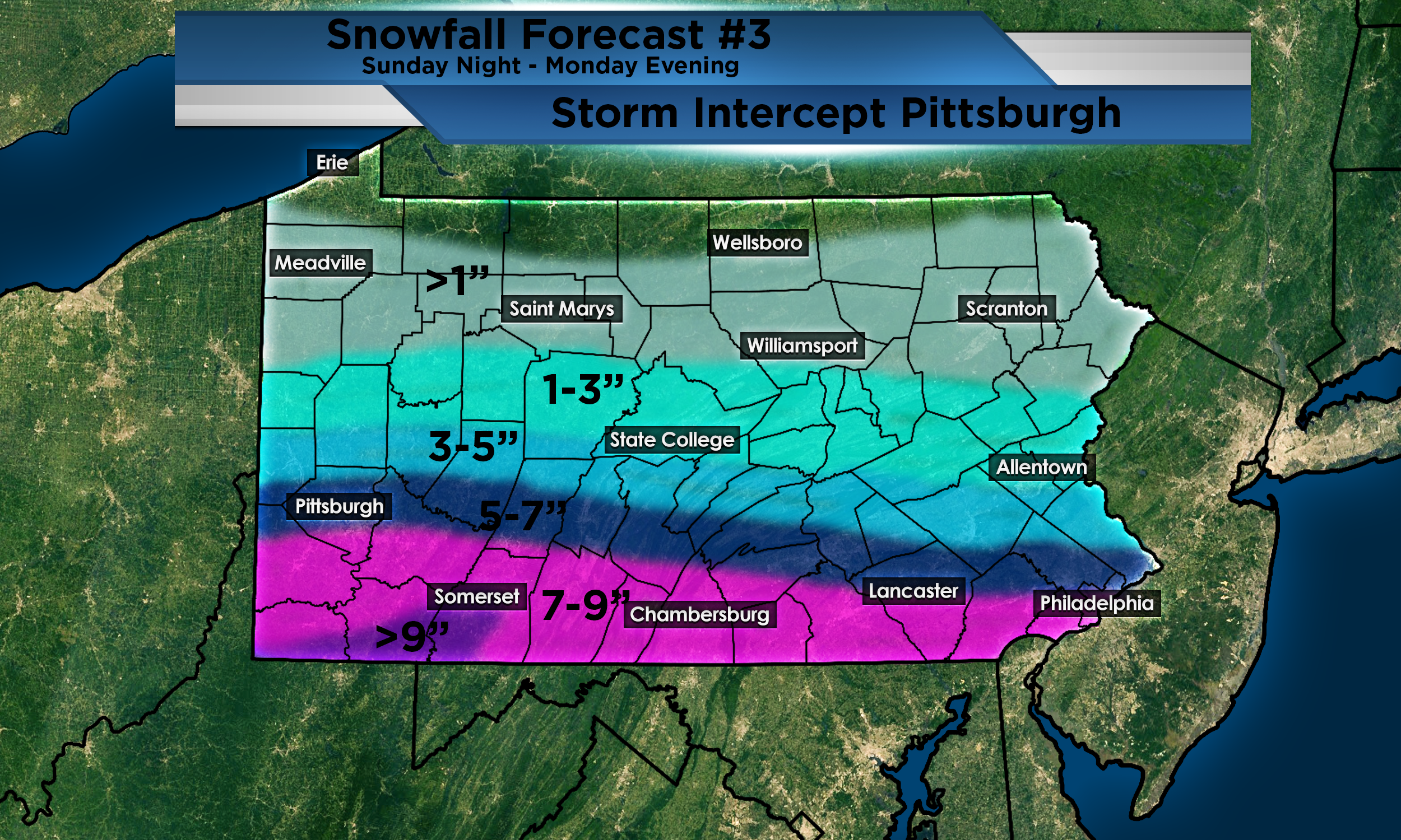
This is my third forecast for the total snowfall for the upcoming winter storm headed for our area. All Winter Storm Watches have been upgraded to Winter Storm Warnings. Winter Weather Advisories have also been added to the counties north of the warnings. Since my last forecast, I have shifted higher totals south. There will be a very tight gradient with the totals. If the storm shifts even 10 miles, those in the 5-7″ range could end up in the 1-3″ range or 7-9″ range depending. If the storm shifts, it will more likely shift north meaning higher totals for more areas. This will likely have some major impacts on travel tomorrow morning. Timing of this storm will begin in most places around midnight and end around 7-9pm on Monday. Frigid temperatures will likely freeze any slush and blown snow on the roadways. Limit your travel on Monday. If you have to leave, make sure you have a plan in place. Always keep extra layers in your vehicle along with an emergency kit. Keep an eye on my social media pages in the event something rapidly changes.
Leave a Reply