
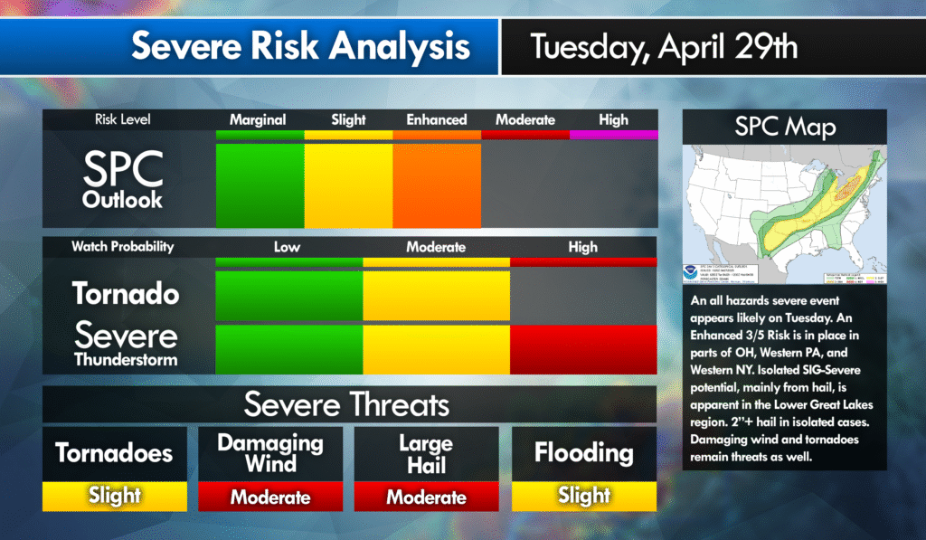
An Enhanced Risk of severe weather
The Storm Prediction Center (SPC) has outlined an Enhanced Risk for severe weather over portions of Ohio, Western PA, and Western NY. Scattered severe thunderstorms are likely Tuesday afternoon/evening. Isolated significant-severe potential is apparent in our region. Main threat appears to be large hail. Especially in the hatched area in the graphic below. All hazards appear likely though.
Synopsis
A shortwave trough should move east across the Great Lakes Region and southeast Canada. The surface cyclone over NE Ontario should quickly progress towards the Canadian Maritimes. A cold front attached low will move across the Great Lakes Tuesday afternoon and Evening.
The eastern extent of a pervasive elevated mixed level will support potential for moderate lift across the warm/moist sector ahead of the cold front. Strong mid-level westerlies should be present. Overall set up could favor discrete to semi-discrete supercells that will eventually merge into clusters/short lines by evening. Confidence is sufficient in upgrading/expanding the categorical risks along with adding a sig-severe highlight for hail.
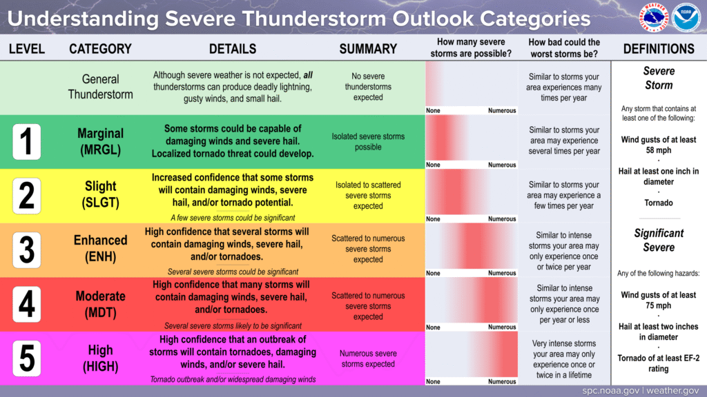
Understanding the spc outlook categories
Stay tuned for updates regarding this potentially significant event on Tuesday!
Leave a Reply