
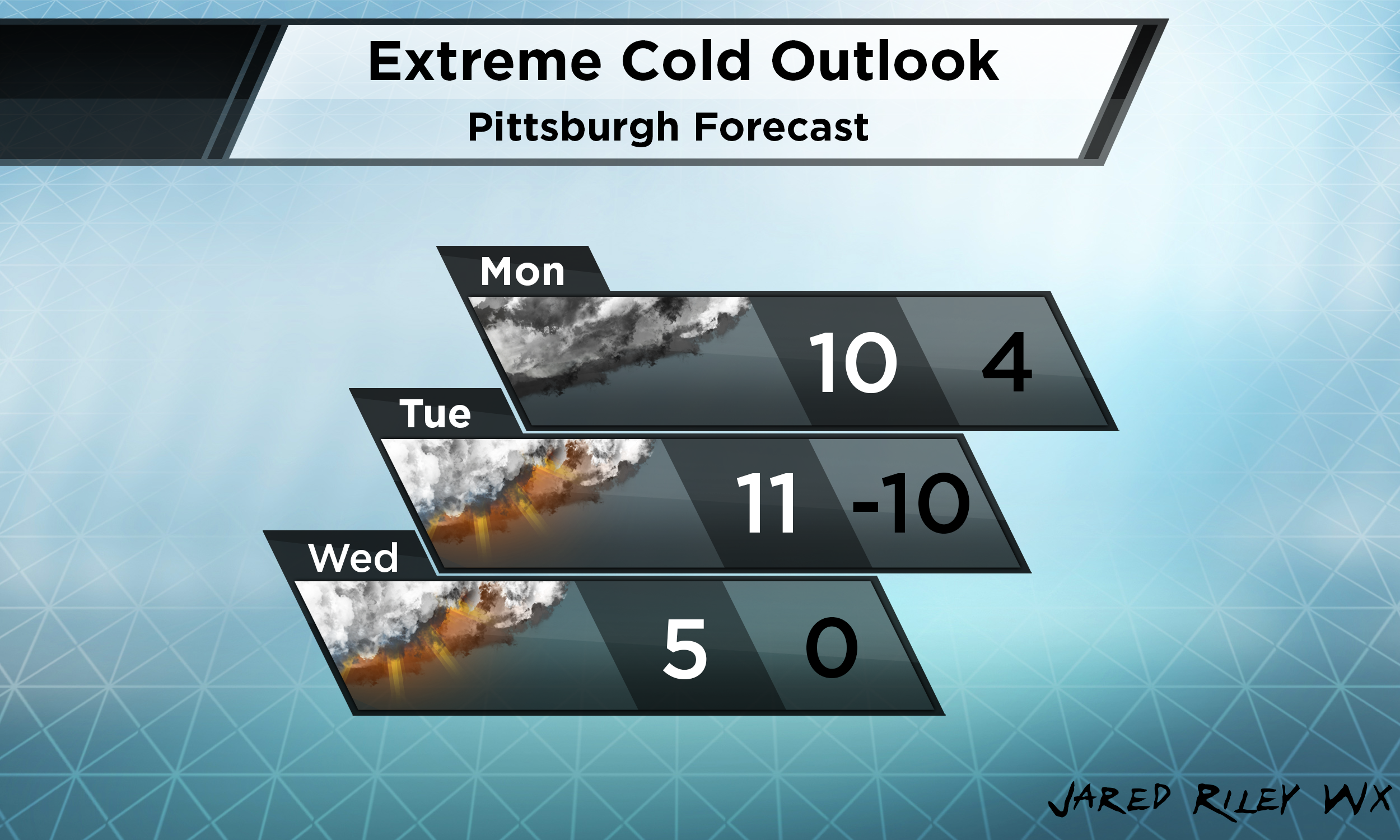
Early next week we are expecting extremely cold air to come down from the Arctic. An Extreme Cold Watch is in effect for most of SW PA. This upcoming weekend we can see some snow showers turn to rain showers as warmer air infiltrates from the south. As the cold air mass pushes down from the north, those rain showers may switch back to snow later in the day. Sunday will be back down into the 20s. Monday will be the start of the arctic blast. Single digit high temperatures are very possible. I currently have it forecasted to barely break the double digits. As we get into the evening hours, temperatures will drop back into the single digits. Tuesday again we may see single digit temps as the high. The coldest period looks to be Tuesday night into Wednesday morning with temperatures dipping well below zero. Wind chills may approach -20 to -30 degrees. Wednesday has the lowest confidence for temperatures but it will still most likely be in the single digits.
These temperatures are extremely dangerous as frostbite can set in within 30 minutes with exposed skin. Power outages may occur due to an increased demand with people heating their homes. Do NOT keep your pets outside for long periods of time. Keep them indoors as much as possible. Pipes may burst if they are improperly insulated. To reduce the risk of burst pipes, insulate spickets outdoors, let water drip in your sinks, and open cabinets that house pipes to give them more exposure to warm air.
Again, these temperatures are extremely dangerous. Limit your time outdoors. If anything significant changes, I will be sure to keep you updated on my social media accounts!
Leave a Reply