
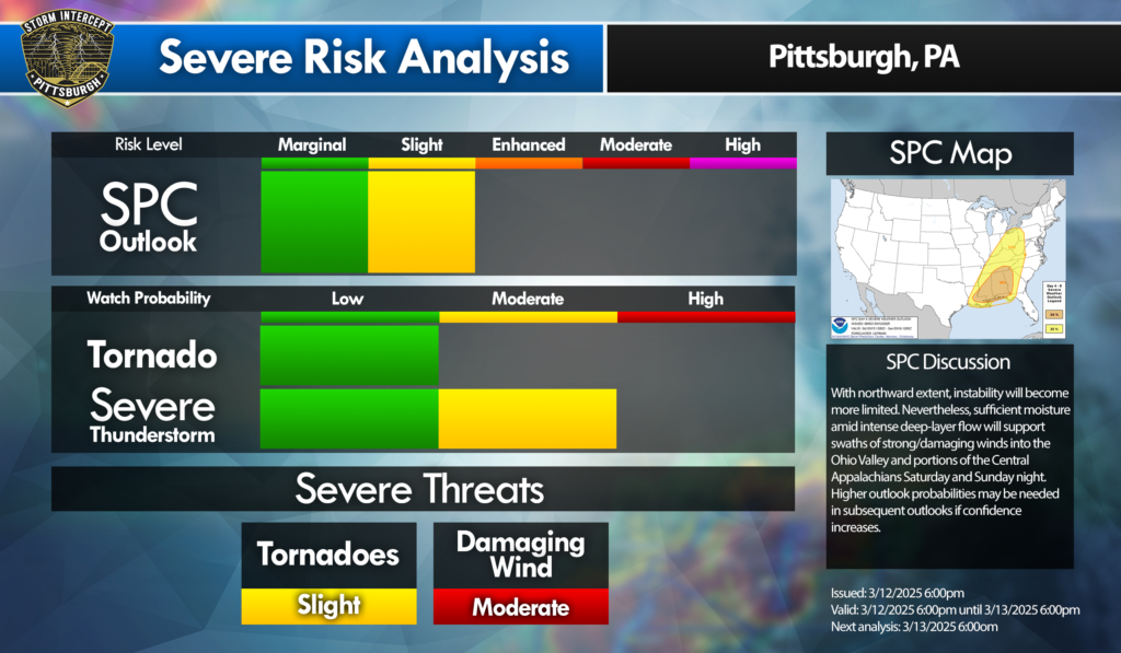
A very strong and intense low-pressure system will impact the area this weekend. The main threat looks to be damaging winds. Hail and tornado threats are still well within the realm of possibility. We can expect to see thunderstorms, possibly meeting severe criteria, on Saturday afternoon and evening. Since this is a Day 4 outlook, only Tornadoes and Damaging Winds were included in the Severe Threats category. Also, the SPC Outlook is limited to Slight (15%) and Enhanced (30%). We will be making updates as they come out over the next few days. Also, a live radar stream will take place on Saturday Afternoon until the severe threat ends. We will be live on YouTube and will answer any questions you may have in the chat! Keep an eye on our social media pages as well as the website to see when we are live! There will be a button at the top of our website where you can click and be directed to our stream!
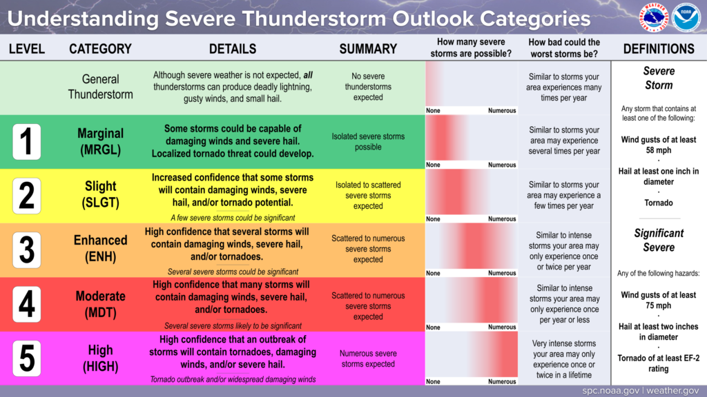
SPC Outlook refresher
For severe weather, the SPC conveys risks over 5 categories. These will show the extent and possible impacts. Take a minute to look at the graphic below!
Leave a Reply