
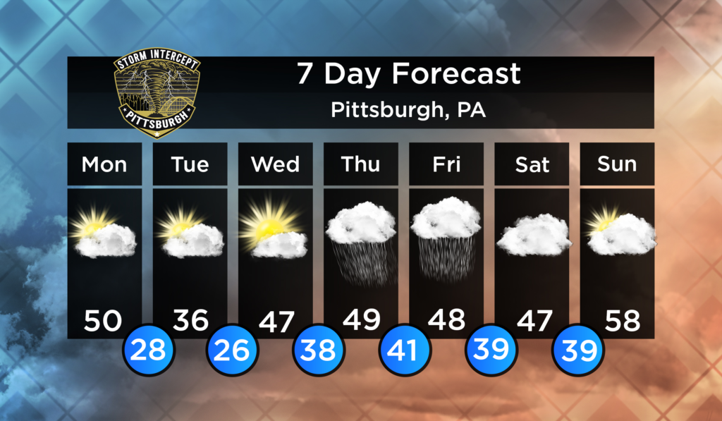
Here is your upcoming 7 Day Forecast!
Early this Week
We are going to begin the week with temperatures below average. A band of precipitation will move through in the early evening on Monday. This may bring a brief band of snow through the area due to the chilly temperatures. No significant accumulation is expected. Behind this band we will see temperatures drop into the 20s overnight and just barely break the freezing line during the day on Tuesday.
Mid-Week
A low pressure system will work its way through our area. Onset of precipitation will be sometime in the evening on Thursday. This will bring rain and possibly some snow showers in areas north of Pittsburgh. No significant accumulation of snow is expected, however, we may see an inch or more of rain. On Friday, expect much of the same as Thursday as the low moves out of our area. On the tail end, precipitation may change over to snow/mix. Again, no significant accumulation of snow is expected on Friday, however, the threat for >1″ of rain is on the table. No severe weather is expected at this time.
Weekend
As the system from Thursday and Friday exits our region, temperatures will begin to return to more seasonable values. Expect plentiful cloud cover through the weekend. The Sun may break through at times. Warmer weather is expected next week.
Leave a Reply